How to find a map to georeference
Information about how to access and use ArcGIS Pro and other ESRI products, including how to download and install ArcGIS Pro, the location of computer labs at Harvard, technical support, workshops, and tutorials.
Learn how to use maps and GIS layers from the Harvard Map Collection in your StoryMaps or ArcGIS Experience Builder project.
How to georeference maps in QGIS
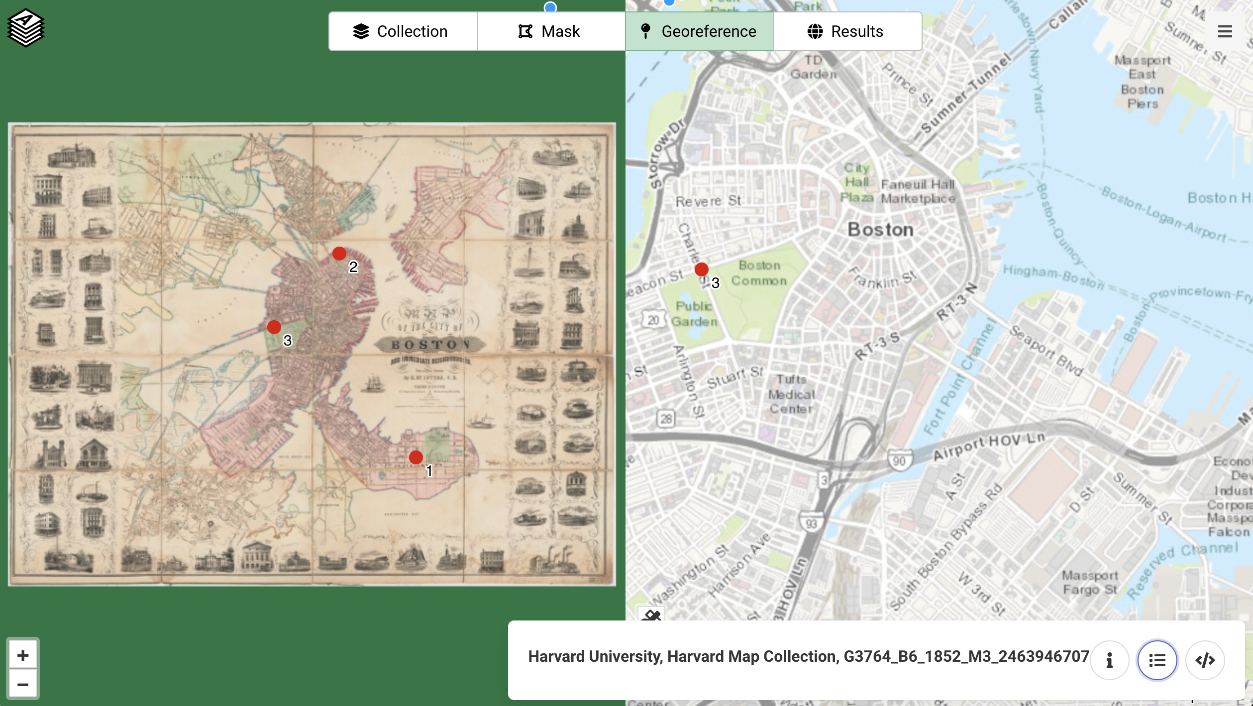
Learn how to use AllMaps to georeference Harvard Library Digital Collections items in the browser, to use in GIS and map making projects.
Learn how to extract OpenStreetMap features by feature type, using the QuickOSM plugin for QGIS.
How to download QGIS and debug malicious software problem, "QGIS can't be opened because Apple cannot check it for malicious software error"
Open a new map in ArcGIS Pro and select the basemap of your choice Map → Basemap → Open Street Map Set the projection by...
Learn how to extract waterways, buildings, transport, places, and land use data from OpenStreetMap.