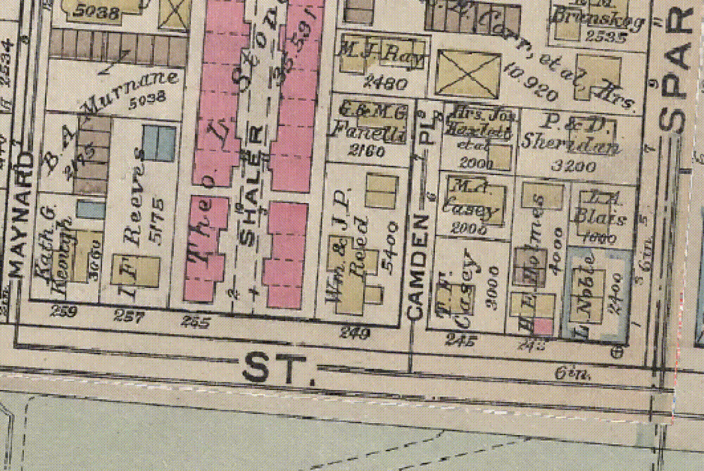
Step-by-step instructions for vectorizing data from historic maps, including an example using Atlascope and spatial analysis.
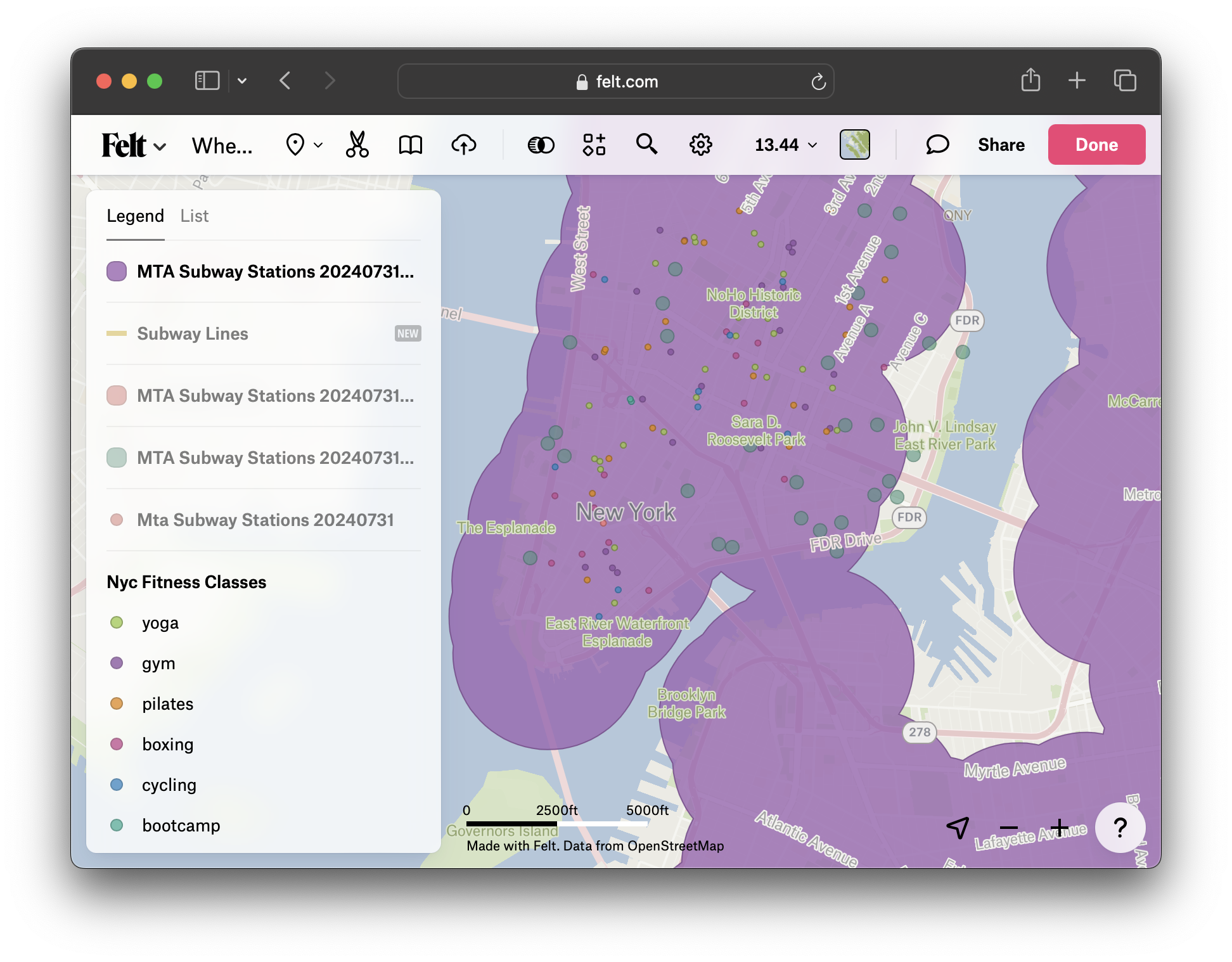
Create .5 mile distance buffers around sample MTA subway stop data in NYC. Visualize the results in a Felt web map. Consider other potential browser-based spatial analysis tools.